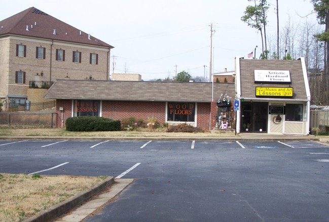
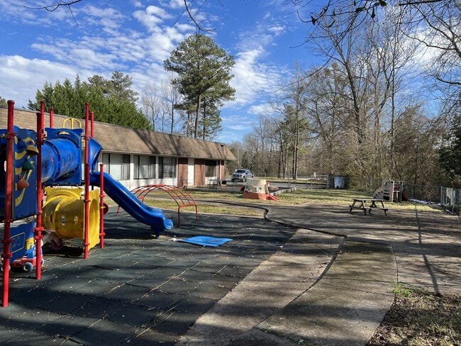
Property Record
1980 Buford Hwy, Buford, GA 30518

Property Detail
1980 Buford Hwy
7-269-022
STATE HWY 13
Daycare
Gwinnett
C2
Georgia
B and X Area of moderate flood hazard, usually the area between the limits of the 100-year and 500-year floods.
0.80 AC
2025
Suwanee/Buford
2025
Atlanta
050105
Atlanta-Sandy Springs-Roswell, GA
4,960 SF
NEARBY LISTINGS FOR SALE OR LEASE
DEMOGRAPHICS near 1980 Buford Hwy
1 mile
3 mile
5 mile
2024 Total Population
5,794
50,237
131,425
2029 Population
6,149
53,335
139,105
Pop Growth 2024-2029
+ 6.13%
+ 6.17%
+ 5.84%
Average Age
37
37
38
2024 Total Households
1,988
16,637
43,771
HH Growth 2024-2029
+ 6.24%
+ 6.28%
+ 6.03%
Median Household Inc
$62,905
$83,263
$94,765
Avg Household Size
2.80
3.00
3.00
2024 Avg HH Vehicles
2.00
2.00
2.00
Median Home Value
$481,481
$438,486
$448,992
Median Year Built
1992
2002
2002
Nearby Places
Map Layers
Map Styles
 Street
 Aerial
Transit
 Traffic
 Biking
Places
Listings with unknown addresses are not visible on the map
- Restaurants
- Banks
- Shops
- Fitness
- Groceries
SALE & LEASE HISTORY
LISTING DATE
SALE/LEASE

Sep 01, 2017
For Lease
Sep 01, 2017
For Sale
Jul 18, 2023
For Lease
Jan 11, 2022
For Lease
Feb 16, 2024
For Sale
The World's #1 Commercial Real Estate Marketplace
Connect with us
© 2026 CoStar Group
The information above has been obtained from sources believed reliable. While we do not doubt its accuracy we have not verified it and make no guarantee, warranty or representation about it. It is your responsibility to independently confirm its accuracy and completeness. Any projections, opinions, assumptions, or estimates used are for example only and do not represent the current or future performance of the property. The value of this transaction to you depends on tax and other factors which should be evaluated by your tax, financial, and legal advisors. You and your advisors should conduct a careful, independent investigation of the property to determine to your satisfaction the suitability of the property for your needs.